

This is a blog post written by Jenna Sutherland – Quaternary Science MSc. student 2014-2015
I have just completed my MSc in Quaternary Science here at Royal Holloway. The main focus of my dissertation research was to understand the dynamic response of an ice sheet to past environmental change since this is frequently poorly understood.
Ice sheets are inherently linked with the atmosphere and ocean, a change in one leads to a change in the other. So, looking in detail at the sediment that was laid down by an ice sheet that has fully disappeared through time allows us to thoroughly understand the processes of past ice flow and the style of glaciation. This enables us to predict how they might respond to changes in the future, meaning we can give more precise and accurate estimates of future sea level rise.
During the last glacial period (the last ice age that occurred from approximately 110 00 to 12 000 years ago) there were ice sheets just like those in Antarctica and Greenland, over Britain and Ireland, Scandinavia, and Canada.
Sediment deposits on the coast of eastern England originate from the Last Glacial Maximum (the period between 21 000 to 27 000 years ago). During this period, ice advanced as far south as the Isles of Scilly in the Irish Sea Basin and north Norfolk on the east coast. Although we know the maximum extent of the ice, the exact ice flow pathways and behaviour of the British-Irish ice sheet has been heavily debated throughout the last century.
My field location, Tunstall, is located in the East Riding of Yorkshire on the Holderness coast. Due to rapid coastal erosion on the east coast constantly exposing new sections of sediment, Tunstall is ideally located within the boundary of LGM tills to capture the sedimentological signal of different ice masses during the last ice age.
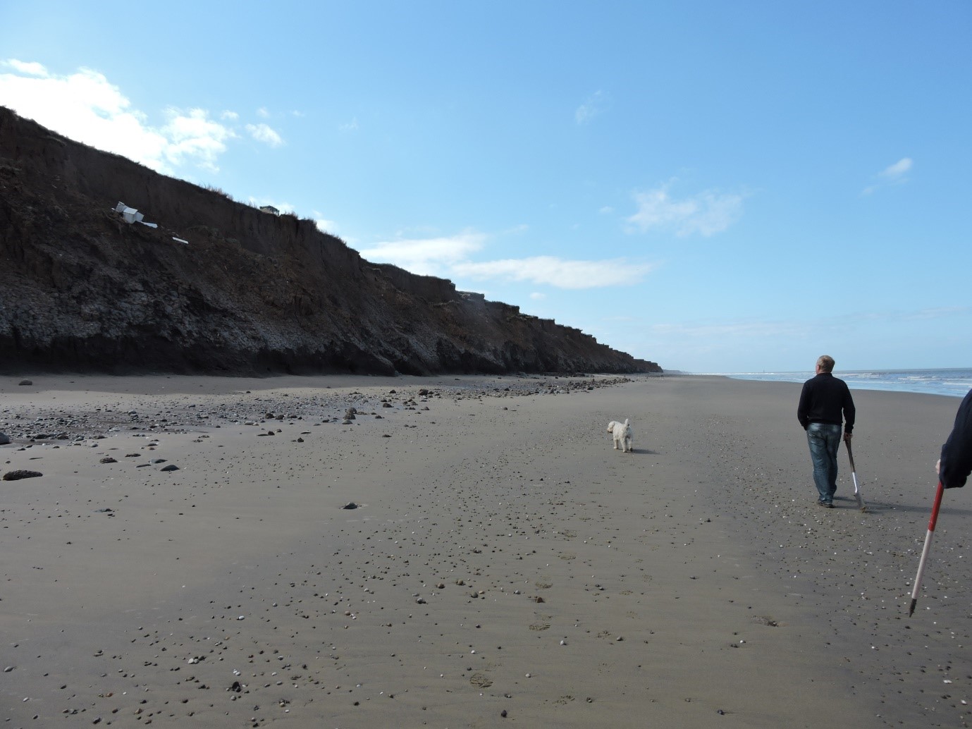
A rare sunny day on the north-east coast
My aims and objectives of the research were to:
- Assess each different sediment unit in the cliff face at Tunstall. What the sediment is made up of and what it looks like can help to infer the environment in which the sediment was laid down
- Identify the lithological composition within the sediments. Knowing where each lithology came from enables us to see where the glacier ice originated
- Determine whether the sediments at Tunstall are related to the wider regional stratigraphy published in the literature (The Skipsea and Withernsea Till units)
As with any research, field work is the best part (in my opinion) and I was lucky enough to have part of this research funded by the Quaternary Research Association (QRA). Altogether I spent about 15 days in Tunstall, split over various weekends.
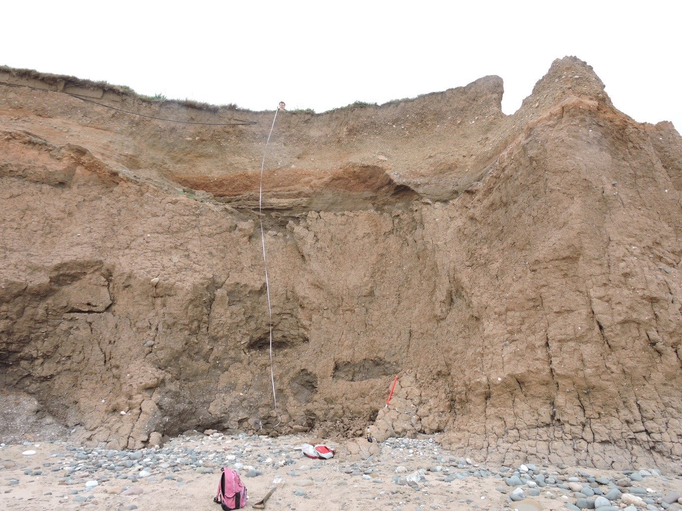
What the majority of the cliff face looked like at Tunstall. Distinct sediment units can be seen via a change in colour and composition, indicating different depositional environments
A large amount of time in the field was spent describing the features of the sediment that are immediately visible to the eye. Sediment logs were drawn up, whereby each different sediment unit from the bottom of the cliff to the top is described in detail (different sediment layers stacked on top of each other represent the order in which they were laid down, the oldest sediment being at the bottom), noting the grain size of the sediment, its colour and composition (eg. clay, sand, gravel, boulders).
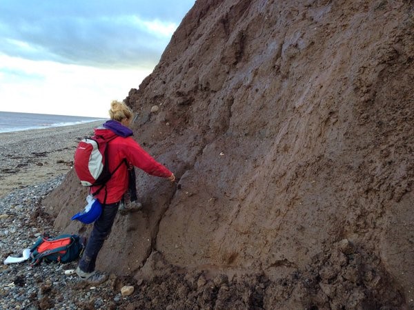
No one said field work was glamorous…..Collecting fracture measurements from the till at Tunstall
The length of the cliff face was photographed and mapped to create a ‘facies architecture map’ in order to characterise the key spatial features of the cliff, and enable the variability along the cliff to be assessed.
The position of stones within a sediment is a useful way of inferring ice flow directions, stones that are elongated orientate their longest axis parallel to the main stress direction. The dip and orientation of up to 50 stones per sample were measured using a compass-clinometer and the orientation of striations on stones as well as vertical fractures within the sediment were also taken.
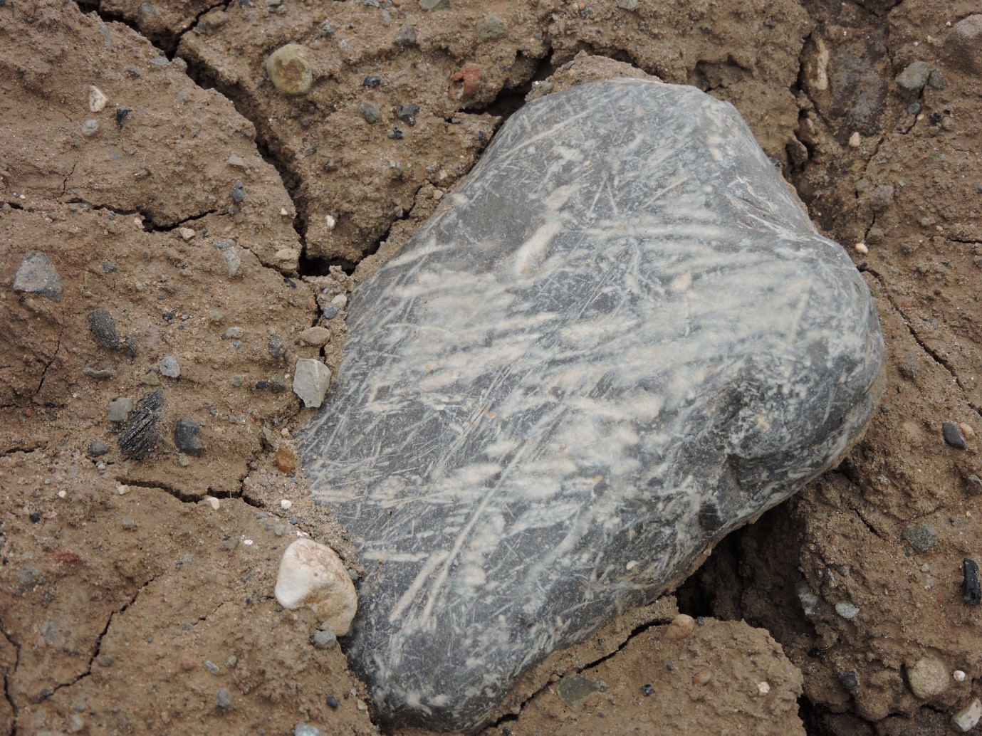
Glacially striated boulder, the lines or scratches represent the direction of ice flow
Numerous samples of sediment were taken from the cliff and taken back to the lab for further analysis….
Particle size analysis (does what it says on the tin) was undertaken in order to infer how well sorted the sediment is. If the sediment is made up of similar sized clasts, it is well sorted. The particle size offers an insight into the erosion, transportation and depositional history of the sediment.
Clast lithological analysis involved identifying where the stones in the sediment have come from, and helps us to provenance the exact pathways of the ice. When the ice moves along the ground from its source area, it rips up, or ‘entrains’ bits of the underlying bedrock and incorporates them into the base layer of the ice. This sediment gets transported as the glacier travels further. Identifying the exact source will help to trace the locations of where each lithology is present in England, and therefore, identify with confidence the place that ice must have flowed over. I identified around 300 stones per sample, that’s 2400 rock identifications in total!
After all this hard work, the results of my research are promising and I am currently working towards getting my paper submitted for publication. This will contribute to helping us to understand more about the dynamism of the British-Irish Ice Sheet during the LGM, used in predicting the likely response of future ice sheet change.
