
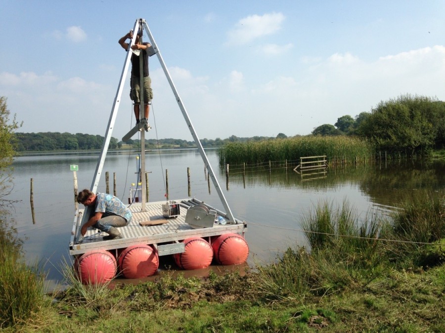
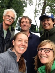
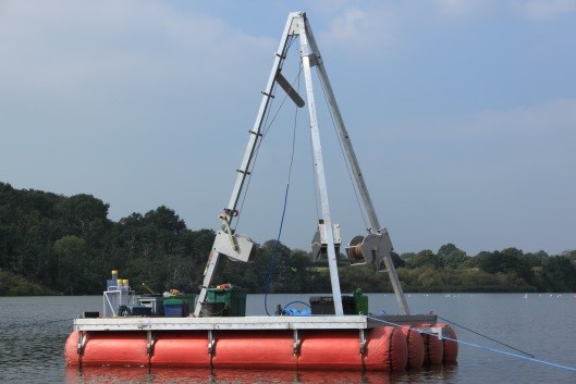
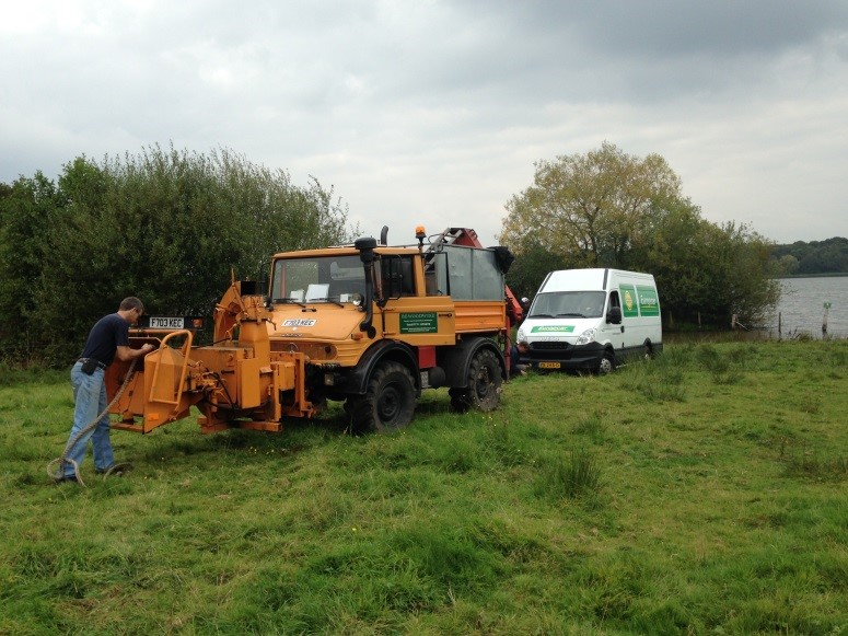
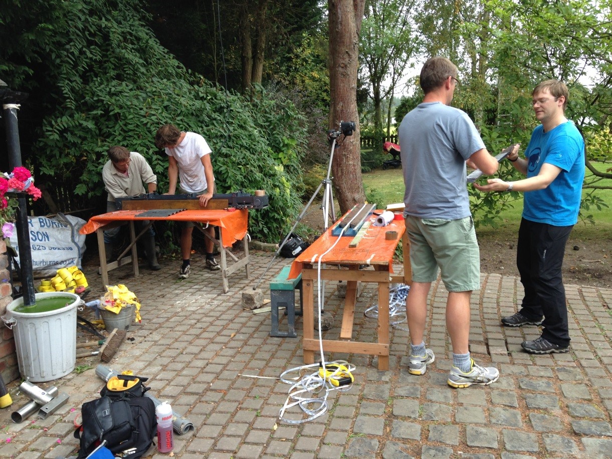
Being my first blog for the CQR, I’ll start by introducing myself . I’m Alison MacLeod, Lecturer in Physical Geography in the department but for the next three years I have a full-time research position funded by the Leverhulme Trust. I also run a 3rd year lecture course on Glacial Environments. The main focus of my research is on the identification and analysis of high-resolution (ideally annual, like tree rings) records of past environmental change both in the UK and other parts of Northern Europe and I use a variety of methods to work out the age and link these records. As part of this I conduct field campaigns in order to gather suitable material to analyse. Last September saw my first field expedition for my new Leverhulme project which was targeting high-resolution lake records covering the time period from the end of the last glacial period to the present day (c. the period from c. 16,000 years before present). Between the 10th and the 14th of September myself plus colleagues (staff and students) from the department of Physical Geography at the University of Utrecht (Figure 1) collaborated to bring over their coring platform to allow us to sample the deep sediments from open lake basins.
This type of sampling (Figure 2) has not been systematically done in the UK for many years (perhaps decades) due to a lack of facility available for use. However, research using this type of platform is prevalent across the rest of Europe and is essential if we are to access key sites which will allow us to further progress our understanding of climatic change and environmental responses in the UK. Big thanks to the UU crew! The majority of current work sampling UK Lateglacialsequences is restricted to the sampling of shallow lake margins or in-filled lake basins.
So, now the introductions are over, where were we and what did we find?
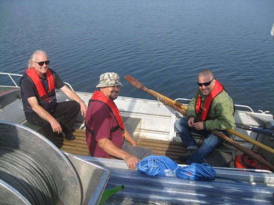
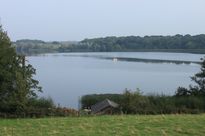
We had been very kindly granted permission to access Rostherne Mere in Cheshire by the reserve manager Rupert Randall (Figure 3) from Natural England.
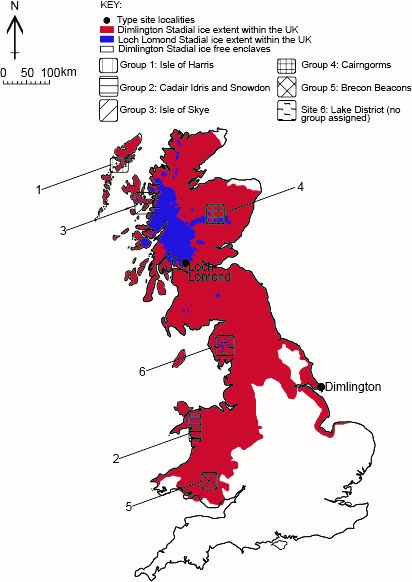
Rostherne is the largest Mere in Cheshire (Figure 4) and it is also the deepest being 31m at its deepest point and on average being about 13.5m. It is located only 19km from the maximum extent of Last Glacial Maximum ice in the UK (Figure 5) and as a consequence of this is likely to have begun to accumulate sediment relatively soon after the climate began to warm and the ice receded. In terms of lake formation mechanisms, it is potentially a complex story but the simplest explanation is that it represents a hollow that developed following ice recession (kettle hole).
More complex proposals relate to much later formation via salt solution (there are salt formations in the nearby geology) and even more complex proposals suggest a combination of both mechanisms.
So, what were we up to? There is a lot of research being undertaken on the Rostherne Mere. A group from Loughborough University are working on the present day ecology, and the history of the lake over the more recent past, and it is this work we in the CQR are looking to integrate with and extend. Our interest lies predominantly in the older sediments that were laid down at the bottom of the lake when it first formed and we aim to answer questions such as when did the lake form and what has the climate been like in this region since it formed? Once we have summarised the information from Rostherne, we will then try to integrate this record into wider data we have gathered to assess for patterns and trends in the style, magnitude, timing, duration and rates of climate changes across the UK and Europe.
As I mentioned previously, the Mere is so close to the maximum ice limit it would also be one of the first places to become ice-free when the climate began to warm (c. 17,000 years ago). After this point it would have started to gather sediment from its catchment that records information about the local and regional vegetation and climate. Because of this, it is possible that it may preserve one of the longest records in the UK. However this is potentially complicated by the formation mechanism but I’ll save more details on this for my next instalment!
Another reason we are interested in this site is because the water is so deep – 31 metres (m). This allows special conditions to develop in the water such that below between 15-25m the water is anoxic meaning there is no biological activity can take place below this point, due to a lack of oxygen, and as such the sediments should be undisturbed. The depth is also significant because it allows the water column to become layered (thermally stratify) with warm water at the top and colder at the base. This changes at particular times of the year. Thus meaning that there is the potential for detecting annual to seasonal signals in the sediment building up on at the bottom of the lake (like tree rings) something like we see in Figure 6 and 7.
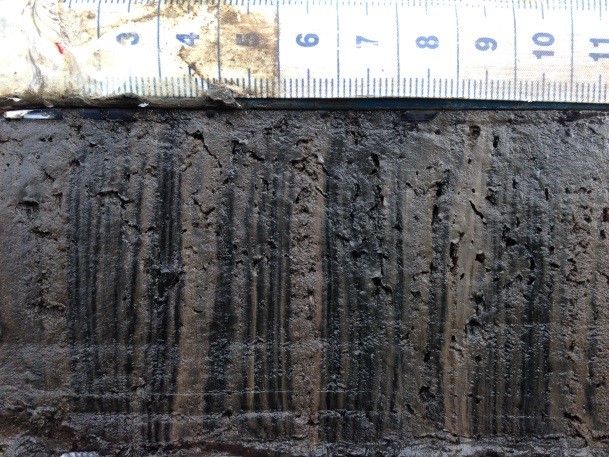
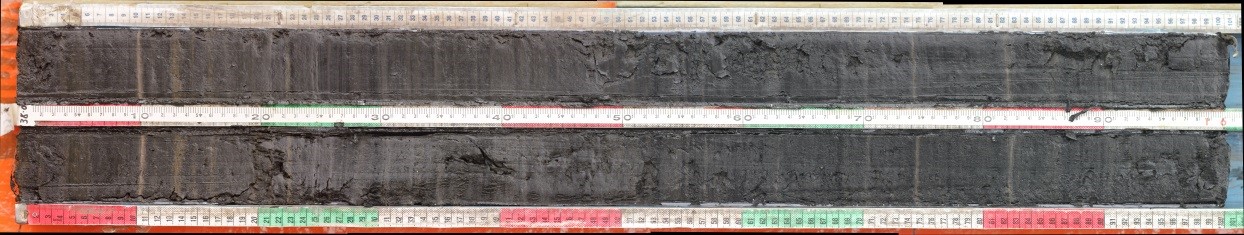
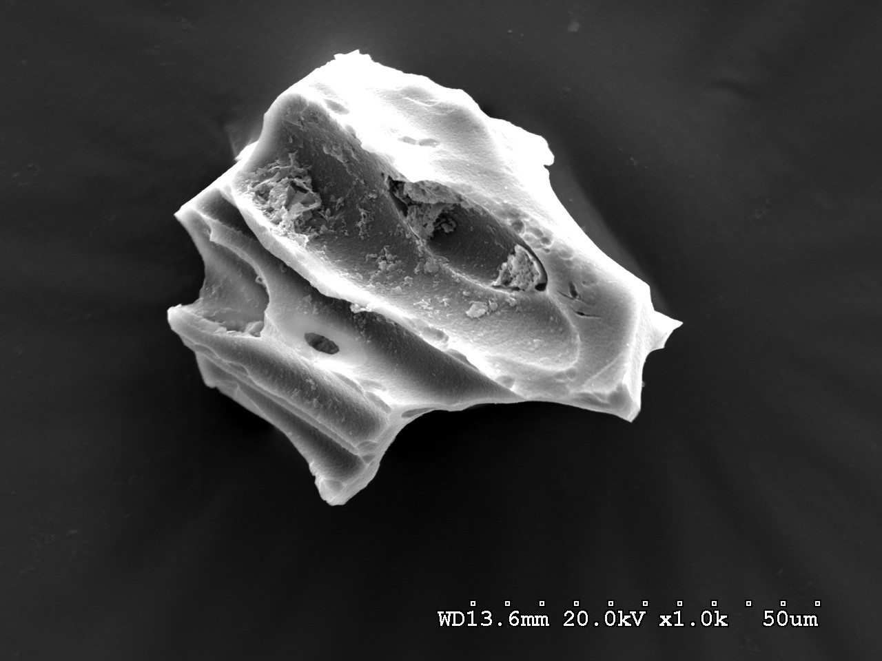
Figure 6 shows light and dark layers. Our hope (once fully analysed) is that each couplet of light and dark represents one year of deposition in Rostherne Mere and that by looking at the composition of each layer, and how this changes over time, we can say what the climate was like each year since the lake formed. We can also count the couplets (using a microscope) to see how many there are and therefore how long the lake has existed for. There may be breaks where the layers are not so clear and it is in these sections where we will apply other techniques such as radiocarbon dating of plant material and tephrochronology (the study of volcanic ash layers; Figure 8) to help us date the sediments more securely. Other proxy analyses which will be carried out on the cores will include pollen (vegetation), chironomid (midges), diatoms (water conditions) and sediment chemistry (amongst many others…..).
So now that I’ve justified the science component what are some other facts and figures from this trip?
- Deepest water cored in: 29.3m (there is a weather station anchored over the deepest point)
- Depth of sediment recovered: 13.85m (previous record for the site was 10.5m but no detailed work was carried out on the cores).
- Sediment plus water depth cored: 43m (we were using previously unused cable and rope on the winches!)
- We hit some form of diamict (sediment containing grains from clay-gravel/pebble size) at the base – this could have potentially been deposited by the glacier before the lake formed.
- Number of cores obtained: 24 overlapping cores each 1m-long
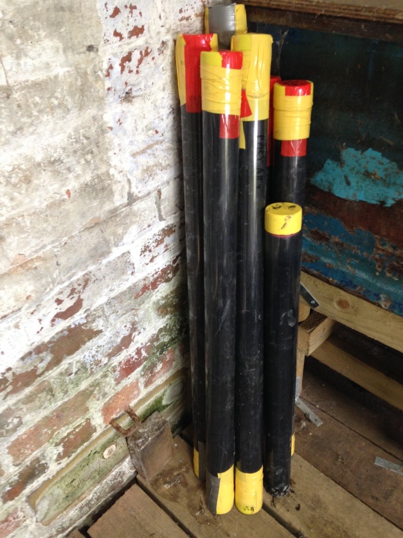
- Problems encountered and overcome: cores coming up from >40m below the lake surface have a tendency to de-gas if left in the sun on the edge of the platform (they expand and if not correctly handled can ooze or explode out of the tubes – see below for an example of the tubes).
- Number of bagels eaten for lunch: 10
- Number of Little Chef breakfasts consumed: 5
- Amount of weight gained: too much!
I realise this is not really giving much information on the science, but that will come in the next instalment once I’ve done some detailed work. Just a wee taster for now of what the plans are.
What else have I learnt? That it is always good to make friends with your local friendly tree surgeon so that when you get stuck in the mud he’s willing to tow you out (Figure 9). And, that if you have a rope and a REALLY strong magnet, you can find and fix just about anything metal at the bottom of a lake!
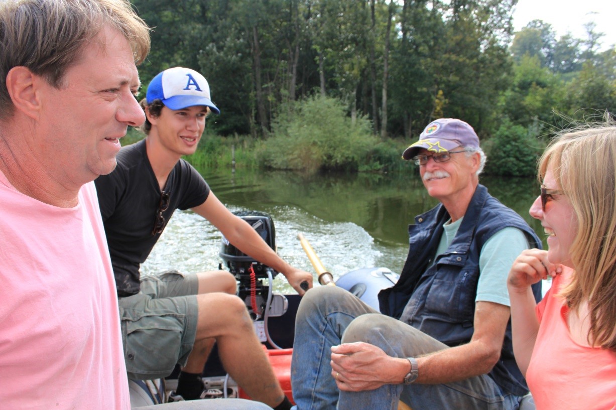
Some more gratuitous shots from the trip for you to enjoy:

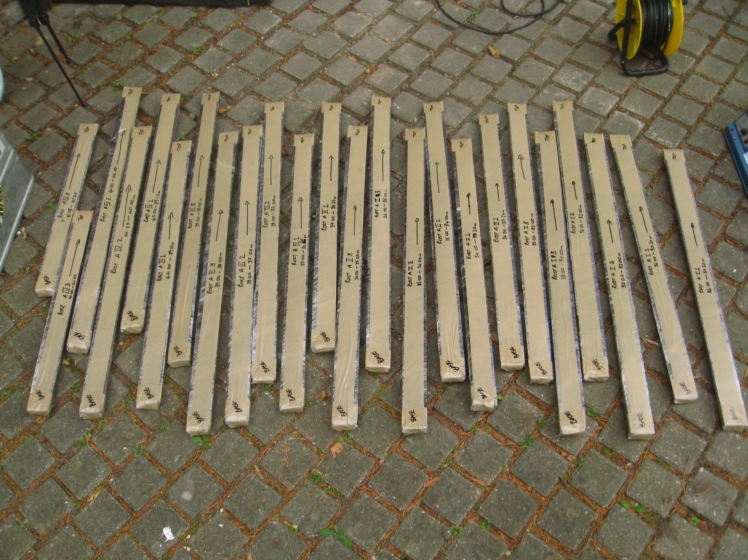
We need to do a lot of work to analyse all 24 1m-long cores we collected in detail but I will be able to update you sometime next year with developments on progress. Alison
